


Sharp Innvotech’s Drone Solutions combine unmanned aerial systems with GIS technology to capture high-resolution spatial data quickly, safely, and cost-effectively. The solution enables accurate monitoring of land, infrastructure, and assets with far greater speed and precision than traditional surveying methods, supporting better planning and decision-making across industries.
Large areas, complex terrain, and time-sensitive projects often make traditional manual data collection slow, expensive, and operationally challenging. In many cases, field surveys also require significant manpower and expose teams to difficult or unsafe working conditions. Satellite imagery, while useful for broad analysis, may lack the resolution, accuracy, or update frequency required for detailed and real-time decision-making in dynamic environments. Drone-based data collection effectively bridges this gap by delivering on-demand, high-resolution aerial intelligence exactly when and where it is needed. It enables faster surveying, improved accuracy, reduced operational risk, and more efficient data-driven decision-making across industries such as construction, infrastructure, agriculture, and environmental management.
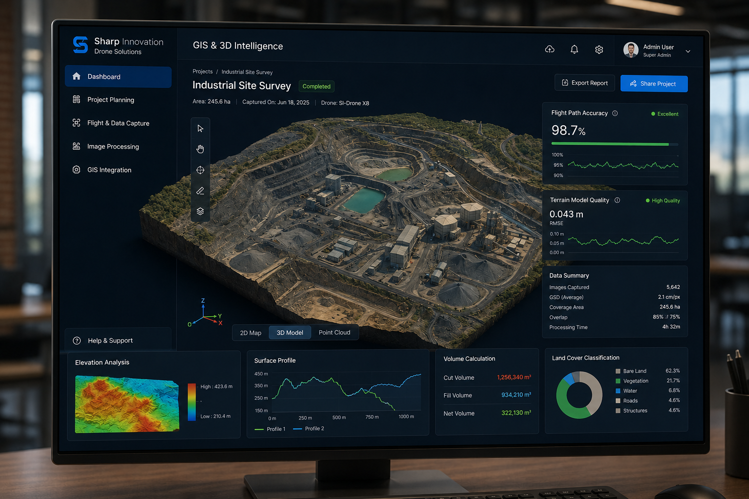
The process begins by defining the project scope, area of interest, and data requirements. Specialists plan flight paths, altitude, and image resolution based on the terrain, infrastructure, or assets that need to be captured. Proper planning ensures accurate aerial data collection using drones and optimal coverage.
Professional drones equipped with high-resolution cameras and sensors fly over the target area to capture detailed aerial images and geographic data. During this stage, drone mapping solutions collect large volumes of spatial data quickly while maintaining high positional accuracy.
The captured images are processed using advanced software to generate GIS-ready outputs such as orthomosaic maps, digital elevation models (DEM), and 3D terrain models. This step converts raw imagery into structured data suitable for drone-based land surveying and spatial analysis.
Processed data is integrated with existing GIS platforms through drone mapping and GIS integration. Organizations can overlay drone imagery with other spatial layers to perform measurements, analyze geographic patterns, and support infrastructure monitoring.
All captured and processed drone data undergoes strict validation to ensure accuracy, consistency, and reliability. Quality checks help eliminate errors and ensure the final outputs meet industry and project standards before delivery.
Final analyzed data is converted into clear reports, dashboards, and visual insights that support decision-making. Stakeholders can use these outputs for planning, monitoring, and improving operational strategies.
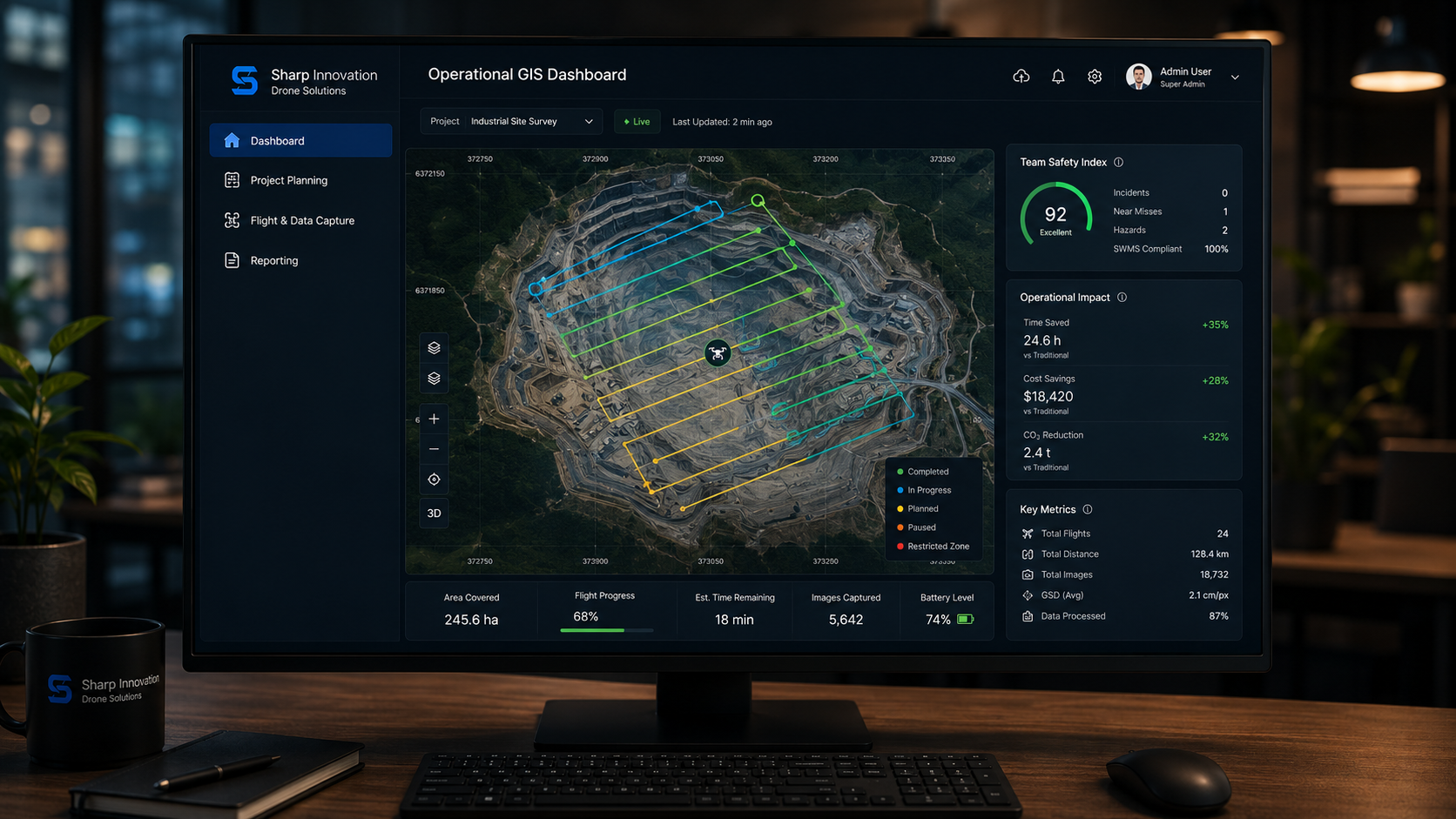
Solutions tailored specifically for your business operations.
Drone technology significantly reduces the time required for surveying and mapping large areas. Compared to traditional ground surveys, drone mapping solutions can capture detailed aerial data within hours instead of days or weeks.
With high-resolution drone imagery, organizations gain extremely detailed views of land, infrastructure, and assets. This accuracy helps in better planning, monitoring, and decision-making.
Aerial inspection using drones allows teams to assess hazardous or hard-to-reach areas such as rooftops, towers, bridges, and industrial sites without exposing personnel to risks.
By minimizing manual fieldwork and reducing the need for heavy equipment, drone-based land surveying lowers operational costs while still delivering precise results.
Drone-enabled systems provide real-time monitoring and instant reporting, allowing teams to track project progress, detect issues early, and make faster operational decisions.
Drone-based inspections significantly reduce operational risks by eliminating the need for manual access to hazardous or difficult environments, ensuring safer workflows.
Accelerating aerial scanning and GIS integration in compliance with Saudi Arabia's digital mapping goals
Sharp Innvotech delivers end-to-end GIS and aerial data solutions designed for reliability, accuracy, and scalability. Its Drone Solutions offering integrates deep geospatial expertise with advanced data processing workflows and secure information management, ensuring consistent and dependable results across diverse project requirements. Organizations choose Sharp Innvotech for its ability to unify drone technology with GIS capabilities, enabling seamless data collection, analysis, and visualization within a single ecosystem. This integration helps businesses improve decision-making through more precise and timely geospatial insights. In addition, the platform is built on a scalable, enterprise-ready architecture supported by ongoing technical and operational assistance. This ensures that organizations can expand their usage as project demands grow while maintaining high performance and data integrity.
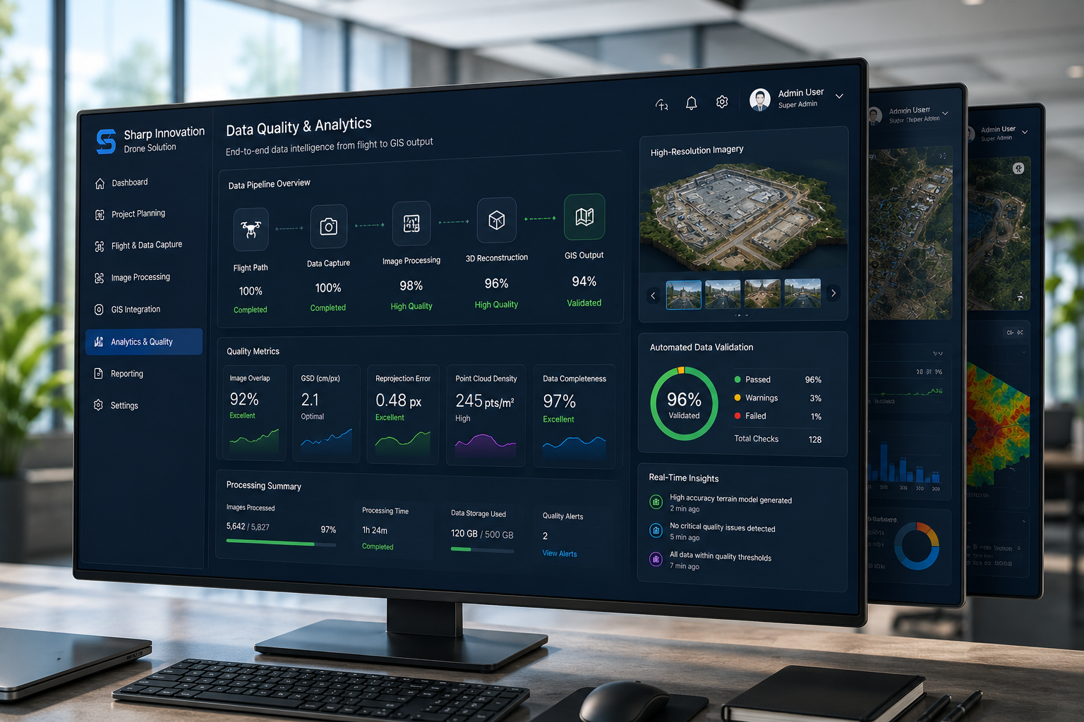
Turn aerial data into actionable GIS intelligence.