


Digitally visualize, analyze, and manage spatial data, land assets, infrastructure networks, and environmental zones through a centralized integrated platform. Streamline planning operations, improve team collaboration and resource utilization, ensure compliance with zoning policies and regulatory land requirements, and enable informed decision-making through real-time geospatial insights and data-driven mapping management.
Using advanced Geographic Information System (GIS) mapping technologies, Sharp Innvotech’s GIS Solutions deliver complete, map-based visibility into land assets, infrastructure networks, and environmental resources. The platform continuously integrates high-quality geographic data from multiple spatial sources including satellite imagery, drones, and telemetry, ensuring full coverage of all critical geographical data points. When integrated with enterprise database records and real-time sensor streams, Sharp GIS provides a powerful, unified view of regional assets and operational terrains. This combination enables real-time situational awareness and detailed spatial analysis for better urban planning, utility tracking, and environmental management. As organizations expand and operate in increasingly complex geographic terrains, relying solely on static maps or manual reporting often leads to limited spatial visibility and fragmented planning. GIS solutions bridge this gap by delivering interactive visual evidence of land assets, enhancing planning safety, supporting accurate geographical impact assessments, and improving overall operational accountability and transparency across departments.
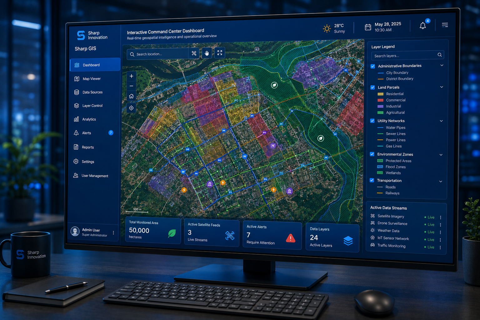
The process begins by collecting spatial data from multiple sources such as satellite imagery, GPS systems, survey data, enterprise databases, and existing geographic information system software. Sharp GIS integrates this information into a centralized integrated GIS platform, ensuring all location-based data is stored in one secure environment.
Once the data is integrated, it is organized into multiple spatial layers. These layers may include infrastructure networks, land boundaries, environmental zones, utilities, or assets. Through advanced GIS mapping and analytics, users can overlay these layers on interactive maps to gain a clearer understanding of geographic relationships.
Sharp GIS analyzes patterns, trends, and spatial relationships within the data. Using advanced analytics, organizations can identify risks, optimize resource allocation, and improve operational efficiency. This geospatial intelligence platform converts complex geographic data into actionable insights that support accurate decision-making.
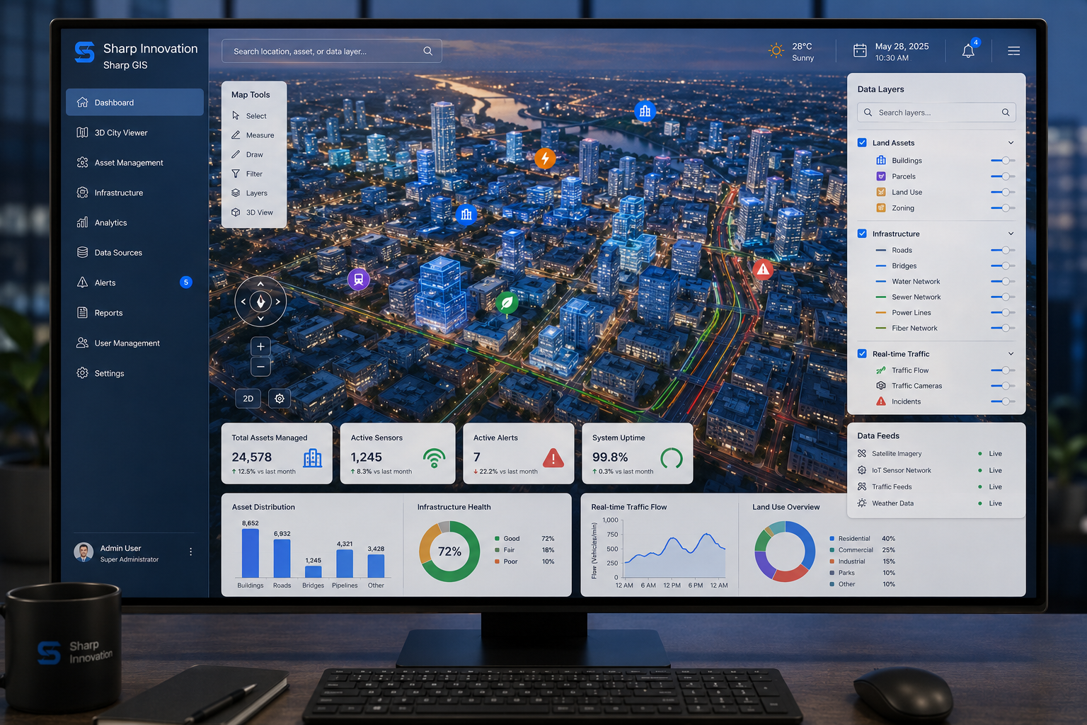
The platform presents insights through interactive dashboards, maps, and reports. Decision-makers can visualize key information using a spatial data visualization platform that simplifies complex datasets into clear, understandable views.
With real-time insights and detailed analysis, teams can plan projects, monitor assets, and make strategic decisions with confidence. Sharp GIS supports GIS for planning and decision making across multiple departments, enabling organizations to respond faster and operate more efficiently.
Solutions tailored specifically for your business operations.
Sharp GIS is built for daily operational use, not just technical teams. The interface is designed to be intuitive for planners, managers, engineers, and decision-makers who need insights without complexity. Users can explore maps, filter data, generate views, and extract insights without relying on manual processes or disconnected tools.
The platform supports a wide range of use cases across public and private sectors, including urban planning, infrastructure management, utilities, land administration, environmental monitoring, and enterprise operations. Sharp GIS adapts to organizational needs through configurable layers, workflows, and access roles, making it suitable for both small teams and large-scale deployments.
Sharp GIS integrates seamlessly with existing databases, enterprise systems, and GIS tools. It supports structured data growth as organizations expand their geographic coverage or data complexity. Whether deployed for a single project or across multiple regions, the platform scales without compromising performance or usability.
Enables instant visualization of live data streams, telemetry, vehicle locations, and active fieldwork updates. This real-time visualization ensures that management teams always have the most current situational awareness to respond immediately to critical incidents or coordinate fieldwork effectively.
Ensures survey-grade precision by utilizing advanced coordinate system translations and high-resolution spatial referencing. This prevents mapping errors, ensures exact property and infrastructure boundaries, and provides reliable data that meets national regulatory standards.
Provides multi-user collaborative environment with role-based access control. Teams from different departments (e.g., planning, operations, maintenance) can access and edit shared maps simultaneously, eliminating information silos and ensuring everyone works from a single source of truth.
Aligning geospatial intelligence with Saudi Arabia's Vision 2030 digital mapping and smart city goals
Sharp Innvotech delivers advanced Geographic Information System (GIS) solutions designed for scalability, reliability, and real-world operational environments. Built to handle complex spatial databases and mapping ecosystems, the company combines deep expertise in geospatial intelligence, data-driven mapping platforms, and digital transformation to deliver enterprise-grade technology that adapts to evolving business needs. With flexible deployment models and seamless integration capabilities, Sharp Innvotech ensures that organizations can implement GIS mapping solutions without disrupting existing workflows. The platform is engineered for long-term performance, offering continuous support, system optimization, and upgrades to meet growing operational and geographical analysis demands. Sharp Innvotech’s Sharp GIS is designed to support everything from local projects to large, regional and multi-agency operations. It enables organizations to centralize control of spatial data, improve geographical visibility, enhance resource efficiency, and make smarter, data-driven decisions—making it a trusted partner for modern geospatial management excellence.
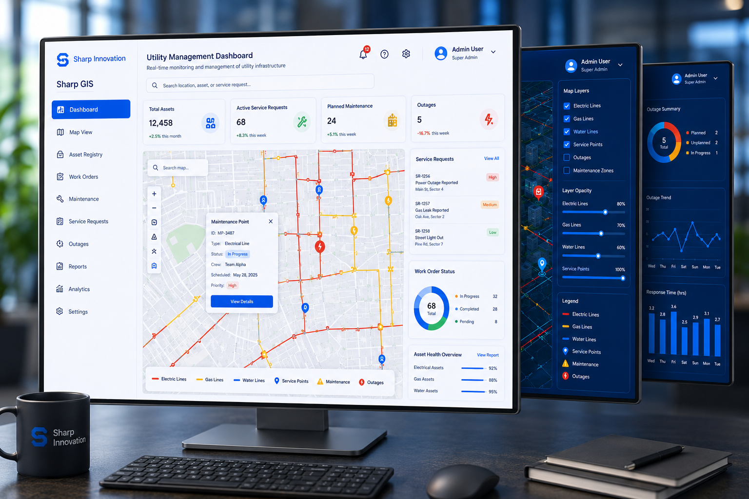
Empower teams with a GIS platform designed for clarity, scale, and impact.